
Flood exposure in Switzerland has increased noticeably over the past decade, driven by expanding hazard zones and continued development in flood-prone areas. A recent national assessment reports that between 2014 and 2023 flood-hazard areas grew by about 30 %, while the number of exposed buildings rose by more than 30 %, leading to a significant increase in potential building damage. Overall flood risk, measured as potential damage, increased by roughly 25 % over the same period. These findings highlight why understanding local flood exposure matters in a changing climate.[1]
Climate change is intensifying flood risks across Switzerland, largely due to more frequent and more intense heavy rainfall. The Federal Office for the Environment classifies flood-related risks — including river flooding and surface water runoff — as high climate risks already today, with further increases expected by 2060 as precipitation intensifies and exposure of buildings and infrastructure grows. On Geoda.ch, you can assess flood risk for any Swiss address using two complementary datasets: surface runoff from heavy rainfall and flooding from rising water levels in streams and lakes, providing a more complete picture of local flood exposure..
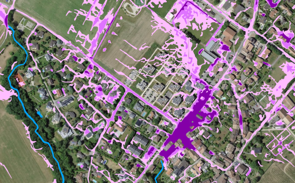
Map illustrating potential surface water runoff and localized flooding during heavy rainfall. Based on public data from the Swiss Federal Office for the Environment (FOEN/BAFU). The map shows modeled indications, not observed flood events.[3].
In Switzerland, about one-fifth of the population is considered at risk of floods, reflecting the country’s exposure to heavy rainfall and overflowing watercourses. To address this, Switzerland invests around CHF 300 million per year in flood protection, which corresponds to about CHF 33 per inhabitant annually. Of this total, the Federal Office for the Environment covers roughly CHF 120 million, with the remainder financed by cantons and municipalities. [4]